


© Sublette County Historical Society 2016

Partners in the preservation of
the New Fork Historical Park
This site is permanently preserved and made
accessible to the public through a strong private-public
partnership involving twenty-one Federal, State,
County, non-profit, private, and corporate organizations.
Thanks to unique agreements with the Bureau of Land
Management, purchase of the property by the Sublette
County Historical Society was funded by industry
donations to mitigate impact of development on the
historic setting of the Lander Trail through the Pinedale
Anticline natural gas field. The site is managed by the
Sublette County Historical Society with the support of
the other organizations.
Federal Government
•
Advisory Council on Historic Preservation –
Consulting party on programmatic agreements
•
Bureau of Land Management – Consulting party on
programmatic agreements, historical research,
donation of sign bases
•
National Park Service (National Trails
Intermountain Region) – Development of site and
interpretation plans, concurring party on
programmatic agreement
State of Wyoming
•
Wyoming Cultural Trust Fund – Grants for
archeology and interpretation signs
•
Wyoming Department of Transportation – Highway
directional signs
•
Wyoming State Historic Preservation Office –
Consulting party on programmatic agreements,
archeology and interpretation review
•
Wyoming Game & Fish Department – Wildlife
friendly fencing, haul gravel, and site monitoring
Sublette County
•
Sublette County Historic Preservation Board
(CLG)–Grants for entrance and regulatory signs
•
Sublette County Road & Bridge – Construction and
maintenance of parking lot and access road
Corporate and Private
•
PacifiCorp – Donation for purchase of property
•
SWEPI LP (Shell) - Donation for purchase of
property, kiosks on highway 191
•
Ultra Resources, Inc. - Donation for purchase of
property, kiosks on highway 191
•
USU Archeological Services – Archeological
investigations
•
Olson 3-H Ranch – Land swap and commitment of
no surface disturbance for mineral rights
Universities
•
Wyoming Conservation Corps (University of
Wyoming) – Bridge, fence and trail construction
•
Utah State University (Spatial Analysis Lab) –
Loan of geophysical equipment and analysis
Non-Profit Organizations
•
Alliance for Historic Wyoming– Concurring party on
programmatic agreements
•
Lander Trail Foundation – Concurring party on
programmatic agreements
•
Oregon-California Trails Association – Concurring
party on programmatic agreements, historical
research, interpretation review, promotion
•
Sublette County Historical Society – Consulting
party on programmatic agreement, ownership &
management of the park
•
Wyoming Archeological Society (Upper Green
River Basin Chapter)– Archeological excavation and
research
•
Wyoming Community Foundation (Sublette
Community Foundation) – Funding for WCC
construction
PARTNERS
Representatives of the organizations involved in negotiation for
funding of the New Fork River Crossing Historical Park. (Standing
left to right) Jay Fear (SCHS), Dan Dockstader (LTF), Larry Elcock
(RMP), Aimee Davison (Shell), Sam Drucker (BLM), Chris Nelson
(RMP), John Huston (BLM), and Clint Gilchrist (SCHS). (Sitting left
to right) Fern Linton (OCTA), Angie Thomas (SCHS), Laurie Hartwig
(SCHS), Jermy Wight (LTF), Lesley Wischmann (AHW), and Tom
Rea (AHW, OCTA). Not pictured Cally McKee (Ultra). Photo
courtesy Sublette County Historical Society.
REPRESENTATIVES
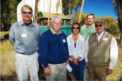
Representatives of the BLM and companies providing funding for
the New Fork River Crossing Historical Park. (left to right). John
Huston (BLM), Larry Elcock (Rocky Mountain Power), Aimee
Davison (Shell), Chris Nelson (Rocky Mountain Power), Sam
Drucker (BLM). Not pictured Cally McKee (Ultra). Photo courtesy
Sublette County Historical Society.
Agreements pave the way for historic New Fork River
Crossing Park Joint media release, September 30, 2010
Historical significance of the
Lander Trail and New Fork River Crossing
Historical Park site
The Lander Trail is part of the federally-designated National Historic Trails. Unlike other emigrant trails that evolved from repeated use, the Lander Trail was actually a constructed road, the first federally funded road west of the Mississippi River. The 256-mile wagon road, built in 1858, started at Burnt Ranch near South Pass, in Wyoming, and ended at Fort Hall in Idaho. It was an alternative to the original Oregon Trail through Fort Bridger, saving up to seven days of travel, avoiding larger desert sections and avoiding expensive ferry crossings over the Green River. The road was engineered and built by its namesake, Frederick Lander. Lander had an extensive background in railroad construction in the east and had been part of the Pacific Railroad Survey in 1853. He worked on improving emigrant trails from 1857 until entering the Civil War in 1861. Lander died from a battle wound in 1862. He estimated that 13,000 emigrants used the new road in its first full year 1859. The road was used extensively until the transcontinental railroad was completed in 1869. The road continued to see some emigrant traffic into the 20th century and played an important role in the settlement of the area. Major river crossings like the New Fork were significant markers for the emigrants because of the peril in crossing, but were also common camp spots. The New Fork River crossing was one of the most difficult on the Lander Trail, and because it followed an 18-mile waterless desert, the crossing was also a camp site for most emigrants. River corridors were later prized homestead sites, so almost all river crossings are now on private land.The Lander Trail today
The Lander Trail has been marked and can be followed on public land for much of its length including the 18-mile desert section through the Green River Valley which is bisected by the Pinedale Anticline. The BLM and companies carefully manage the road through the Anticline with a no surface occupancy (NSO) for ¼ mile on each side of the trail. Additionally a 3-mile viewshed buffer limits drilling activities, and best management practices minimize impacts to the road setting. "The New Fork River Crossing land purchase marks a milestone in the achievement of adequate mitigation for impacts to cultural resources like the Lander Road due to the development of natural resources in the area," said David Welch, Oregon-California Trails Association, National Preservation Office. Realistically, it is not possible to eliminate all impacts to the road setting. Instead of mitigating each separate impact to the road (i.e. a new well pad) as natural gas development progresses, these agreements recognize the overall effects over the life of the development and define an appropriate collective mitigation. John Fowler, Executive Director of the Advisory Council on Historic Preservation said, "This was a good outcome for all parties, demonstrating how the Section 106 of the National Historic Preservation Act enables projects while protecting our heritage when creatively applied. The BLM mitigated adverse effects to the historic Lander Trail from both a new transmission line and additional gas and oil development. It permitted both efforts to proceed while protecting the historic river crossing by placing it in the hands of the Sublette County Historic Society."Plans for the New Fork River Crossing Park
The New Fork River Crossing Historical Park sits about 5 miles west of the crest of the Anticline and just on the edge of the Pinedale Anticline Project Area (PAPA). The park is 104 acres in size with more than half a mile of river frontage. The setting at the park is very similar to what emigrants experienced 150 years ago. The goal is to leave the area as untouched as possible, so development of park facilities will be minimal. A parking lot will be developed at the entrance and the rest of the property will be accessible only by walking trails with interpretive signs. The park will be open in the summer for day use with no overnight camping. SCHS plans to open the park sometime during the summer of 2011. "The New Fork River was an oasis after the desert to emigrants 150 years ago, half way along their 6-month journey to Oregon or California. During the peak summer months hundreds of people each day camped here before or after braving the dangerous crossing. After the emigrant era, the crossing was never cultivated, so remains today much like what the emigrants experienced. The gas development through the Pinedale Anticline could last a generation or two, but the New Fork Crossing Historical Park will now last forever. This is a tremendous legacy Shell, Ultra, PacifiCorp and the BLM have made possible," said Clint Gilchrist with the Sublette County Historical Society. Related Links: Wyoming Conservation Corps helps with new historical park - Pinedale Online, May 30, 2011 Oregon-California Trails Association (OCTA)
Preserving the New Fork River Crossing site
Lander Trail
New Fork River Crossing
Historical Park

Sublette County Historical Society, 307-367-4101, PO Box 909, Pinedale, Wyoming, 82941
info@newforkpark.org


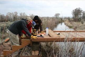
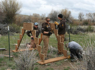
WCC crew, building footbridge, 2011
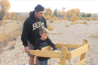
WCC crew, building fence stile, 2011
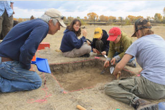
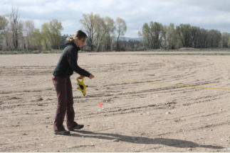
Archaeology, WY Cultural Trust Fund, 2011 & 2012
Archaeology, Dr. Ken Cannon, 2011 & 2012
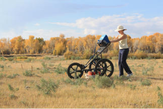
Achaeological Surveys, Molly Cannon, 2011 & 2012
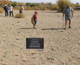
Public Archaeology Dig, 2012
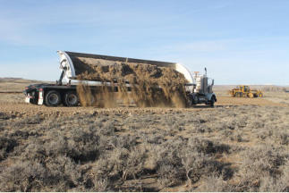
Parking lot, Sublette County, 2012
Parking lot & ADA trail, Sublette Co. Road & Bridge, 2012
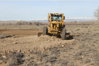
Parking lot & trails, National Park Service, 2012-2014
Advisory Council on Historic Preservation
Nancy Brown
Alliance for Historic Wyoming
Lesley Wischmann
Bureau of Land Management
Ranel Capron
David Crowley
J.D. “Sam” Drucker
Shelly Gregory
Chuck Otto
Judyth Reed
Don Simpson
Businesses & Organizations
Bonneville Archaeology
Josh Criddle, Pinedale Rental
Joe Kautza, Rocky Mountain Sculpture
Office Outlet
Pinedale FFA
Pinedale Lions Club
Pinedale Online!
Pinedale Rental
Kent Profit, KP Trucking
Rocky Mountain Sculpture
Western Veterinary Clinic
Wyoming Trails District Boy Scout Troop 18
Individuals
Joel Bousman Family
Hannah Cackler
Teresa Cackler
Joe Kautza
Mike Kautza
Mindi Crabb
Cody Criddle
Josh Criddle
Spencer Criddle
Stephanie Crockett
Robert Cross
Joseph Debebe
Bob Diehl
Ian Douglas
Levi Douglas
Rosie Douglas
Jolene Everitt
Mackinzie Everitt
Jeff Goltz
Martin Hudson
Jerry Kirchhoff
Reggie Moritsch
Trevor Moritsch
Tyler Moritsch
Duncan Murdock
Riley Murdock
Sarah Murdock
Judi Myers
Rollie Myers
Ann Noble
Maureen Rudnick
Megan Sharpless
Jamie Schoen
Sara Schults
Summer Schultz
Gary Stephenson
William Stephenson
Karen Stewart
Nathan Stewart
Garley Swain
Bill Wadsworth
Lander Trail Foundation
Jermy Wight
National Park Service
Sharon Brown
Steve Burns
Correen Kolisko Donnelly
Kimberly Finch
Lee Kreutzer
Aaron Mahr
Chuck Milliken
Stacy Myers
Olson 3-H Ranch
Ena Olson
Mike Olson
Mack Olsen
Oregon-California Trails Association (OCTA)
Travis Boley
Randy Brown
Kathy Conway
Don Hartley
John Krizek
Fern and Fred Litton
Dave Mead
Tom Rea
Bill Watson
Dave Welch
PacifiCorp
Larry Elcock
Brian Fritz
Jeff Hymans
Rick Lungman
Nancy Sikes
Shell
Aimee Davison
Darci Sinclair
Sublette County
Joel Bousman
Bill Cramer
Matt Gaffney
Mary Lankford
Jim Latta
John Linn
Andy Nelson
Sublette County Historical Society
Dawn Ballou
Jon Boroff
Hannah Braun
Peggy Bryant
Tim Crawford
Sam Drucker
Derick Farr
Jay Fear
Kimberly Fletcher
Clint Gilchrist
Laurie Hartwig
Jim Mitchell
Millie Pape
Geoff Sell
Jackie Sell
Sam Sharp
Angie Thomas
James Thomas
Ron Wilson
Sublette County Historic Preservation Board
Kim Andrews
Dawn Ballou
Bob Beiermann
Clint Gilchrist
Janet Montgomery
Paul Scherbel
Jonita Sommers
Dave Vlcek
Sublette County Road & Bridge
Rob Binning
Casey Calhoun
Duke Early
Mike Egle
Doug Mika
Vod Orr
Billy Pape
Butch Penton
Ron Smith
Mark Steele
Austin Wright
Sublette County School District #1
Rex Hamner, Sublette County FFA
Ultra Petroleum
Cally McKee
Upper Green River Basin Chapter, Wyoming Archaeological
Society
Barry Fisler
Mike Hawkins
Maxine Leckie
Jocelyn Moore
Courtney Skinner
Monte Skinner
Mary Lynn Worl
USU Archaeological Services
Ken Cannon
Molly Cannon
Brennen Cannon
Quincy Cannon
Cody Dalpra
Patty Jackson
Courtney Johnson
Houston Martin
Gary O’Brien
Jason Patton
Jonathan Peart
Utah State University Geoarcheology Field School
Judson Finely and students
Molly Cannon – Spatial Analysis Lab
Wyoming Community Foundation
Janet Bellis
Alexis Berg
Carolyn Bing
Jason Clark
Ana Cuprill
Sam Dadelahi
James Duran
Becky Gregory
Nancy Guio
Julia Healy
Dayle Read Hudson
Debi Morely
Wyoming Conservation Corps
Nancy Davidson
Tyler Dooley
Patrick Harrington
Amy Healy
Sam Nissim
Julie Postma
Jade Shevling
Tyler Shevling
Tim Sowecke
Wyoming Cultural Trust Fund
Renee Bovee
David Cunningham
Jim Davis
Dave Kathka
Nancy Schiffer
Susan Stubson
Wyoming Department of Transportation
Pete Hallsten
Darin Kaufman
Wyoming Game & Fish Department
Miles Anderson
Cade Clark
Butch Parks
Floyd Roadifer
Hilda Sexhauer
Brianne Thiele
Wyoming State Historic Preservation Office (SHPO)
Richard Currit
Mary Hopkins
Beth King
Laura Nowlin
Judy Wolf


